Atlante.mondiale.hoepli.1899
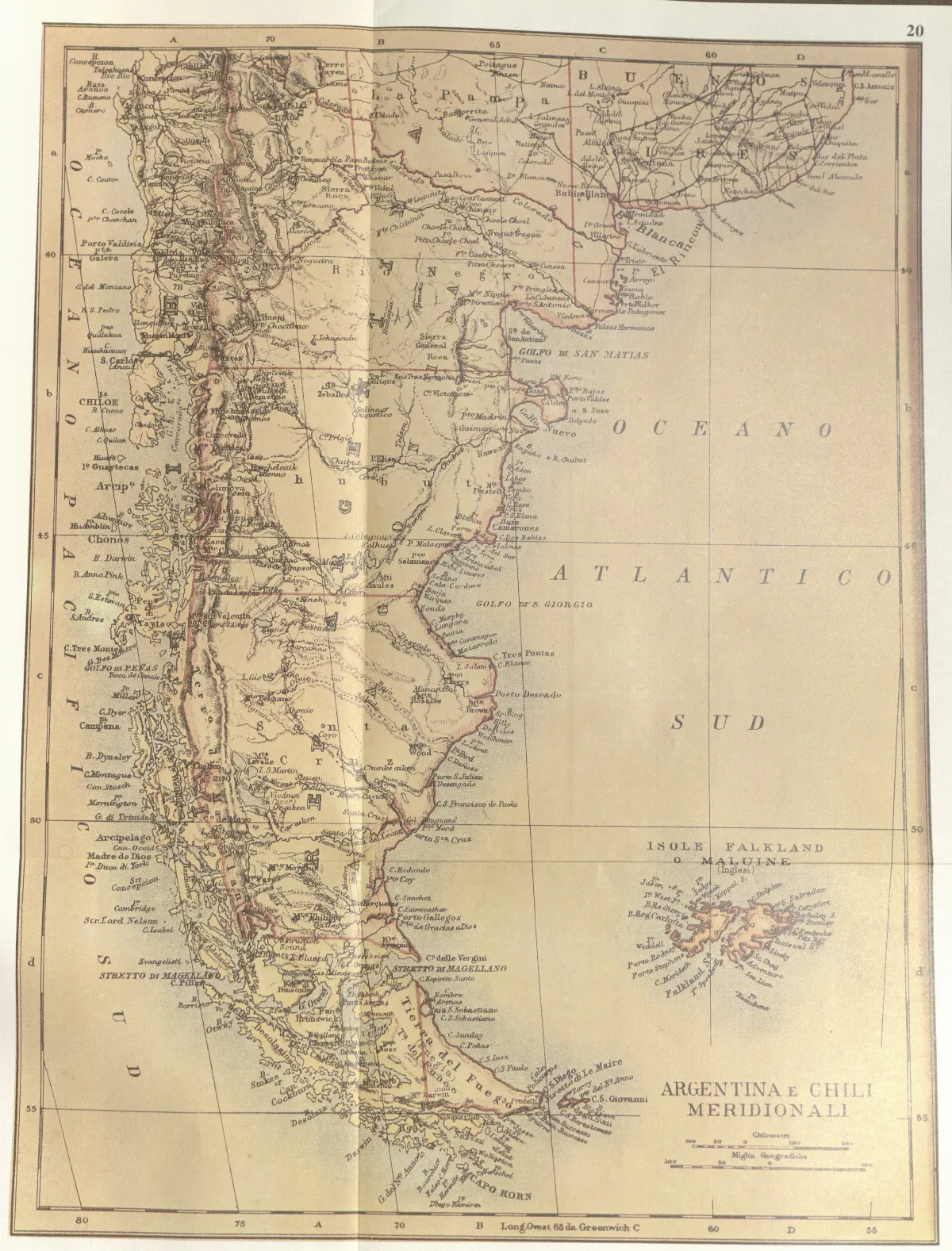
The map "Argentina e Chili meridionali" (Southern Argentina and Chile) partially reproduced here is included in the work "Atlante Mondiale Hoepli", by Giovanni Roncagli, Naval Lieutenant and Secretary General of the Italian Geographical Society and published in Milan in 1899. In this map there is no international boundary traced in the Beagle Channel, but differences in the coulorings given to the territories belonging to Chile and Argentina show Chilean sovereignty over Picton, Nueva and Lennox Islands and all the other islands extending southward as far as Cape Horn.
Licencia Fecha
1899 (Ano)
Etiquetas
Wikimedia Commons
Década 1890
Fuente / Crédito
Giovanni Roncagli — Wikimedia Commons (Dominio público)
Parte del fondo
Fondo Wikimedia Commons — Chile CDA-WIKI-001 Fotógrafo
Giovanni Roncagli
Subida por
Wikimedia Commons
Comentarios
No hay comentarios aún. Sé el primero en comentar.