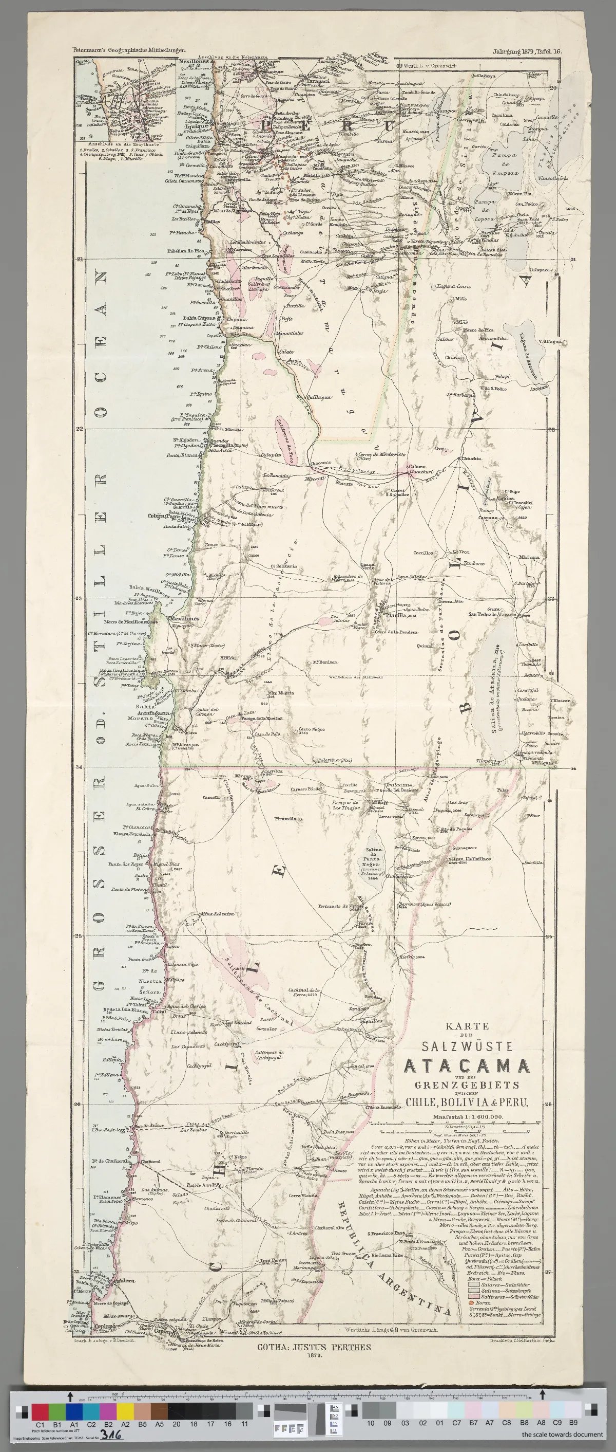
Karte der Salzwüste Atacama und des Grenzgebiets zwischen Chile, Bolivia & Peru
1 Kt. : teilw. kolor. (19 x 53 cm). Maßstab 1 : 1 600 000. Koordinaten W 71°04'00"-W 67°56'00"/S 19°46'00"-S 27°23'00". Aus: Petermann's Geographische Mittheilungen / August Petermann. - Maßstab in graph. Form (Kilometer, Engl. Statute Miles). Titel, Maßstab und Legende unten rechts. Mit 1 Nebenkt.: Anschluss an die Hauptkarte. Relief: Plastisch. Oben rechts: Jahrgang 1879, Tafel 16
Licencia Fecha
1879 (Ano)
Lugar +5 pts
Etiquetas
Wikimedia Commons
Década 1870
Fuente / Crédito
Domann, Bruno ; Perthes, Justus ; Hellfarth, Carl ; Petermann, August (Herausgeber/-in) — Wikimedia Commons (CC0 1.0)
Fuente original
https://commons.wikimedia.org/wiki/File:Karte_der_Salzw%C3%BCste_Atacama_und_des_Grenzgebiets_zwischen_Chile,_Bolivia_%26_Peru.jpg Parte del fondo
Fondo Wikimedia Commons — Chile CDA-WIKI-001 Fotógrafo
Domann, Bruno ; Perthes, Justus ; Hellfarth, Carl ; Petermann, August (Herausgeber/-in)
Subida por
Wikimedia Commons
Comentarios
No hay comentarios aún. Sé el primero en comentar.