Kingsaward.1902
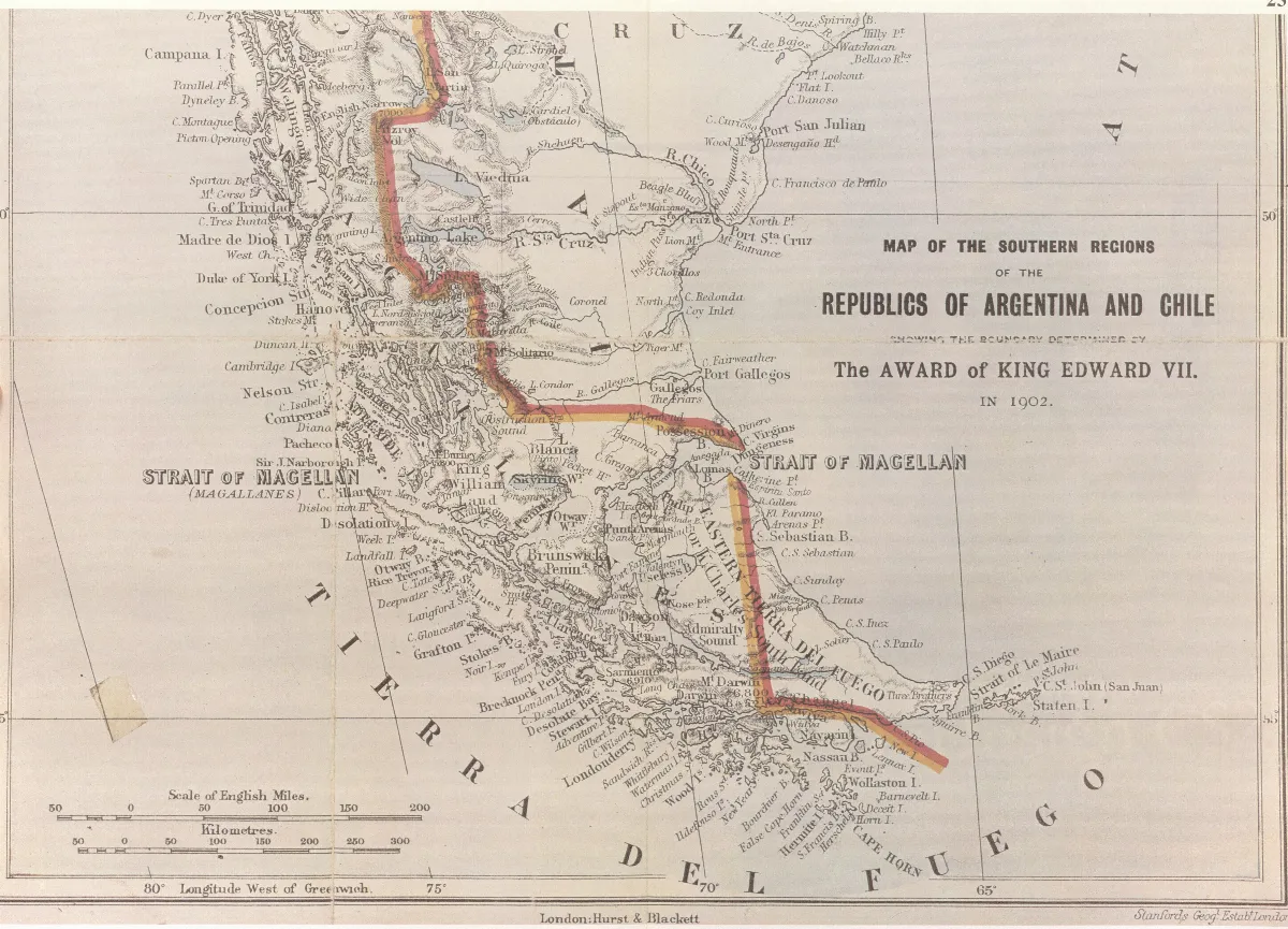
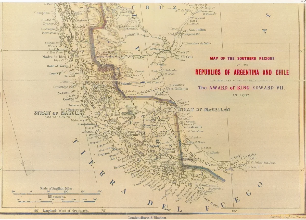
Map "The southern regions of the Republics of Argentina and Chile" - 1904. This map, whose southern part is reproduced here, is included in Col. Sir Thomas Holdich's work "The Countries of the King's Award" written inmediately after his work on the British arbitration of 1898-1902. After the British Arbitral Award of 1902 and during the course of the work marking out the frontier line indicated therein, Col. Holdich visited the Beagle Channel zone which was not included in the arbitration. In the Beagle Channel region the map marks the international boundary as passing through the latter up to beyond its eastern mouth. Picton, Nueva and Lennox Islands and all the other islands extending southwards as far as Cape Horn are shown as under Chilean sovereignty
Licencia1904 (Ano)
Col. Sir Thomas Holdich (1843-1929) — Wikimedia Commons (Dominio público)
Col. Sir Thomas Holdich (1843-1929)
Wikimedia Commons
Comentarios
No hay comentarios aún. Sé el primero en comentar.