
Lagrandeencyclopedie.1890
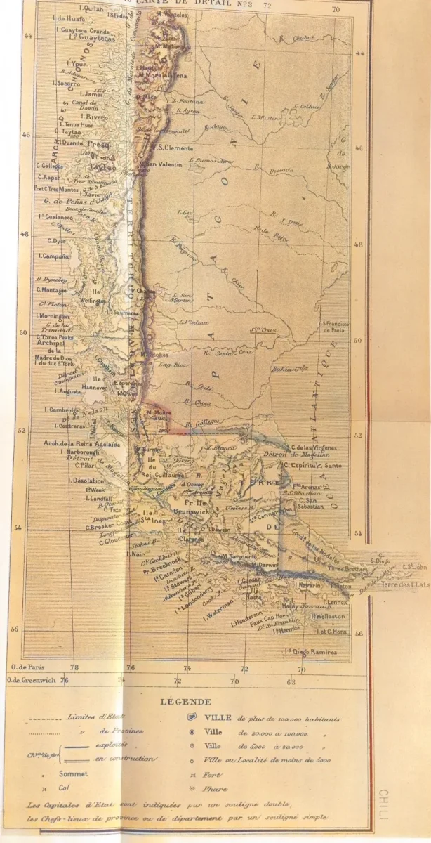
This map, partially reproduced here, is included in the part corresponding to Chile in "La Grande Encyclopedie" published in paris 1888-1890. Both in the part corresponding to Chile and in the map illustrating the article, the boundaries of the Treaty between Chile and Argentina of 1881 are correctly drawn. Thus in the extreme southern region the international boundary is traced along the centre of the Beagle Channel to beyond its eastern mouth, indicating Picton, Nueva and Lennox Islands and all the other islands and islets extending southward as far as Cape Horn as under Chilean sovereignty
Licencia1890 (Ano)
"La Grande Encyclopedie" — Wikimedia Commons (Dominio público)
"La Grande Encyclopedie"
Wikimedia Commons
Comentarios
No hay comentarios aún. Sé el primero en comentar.