LaIlustracionArgentina
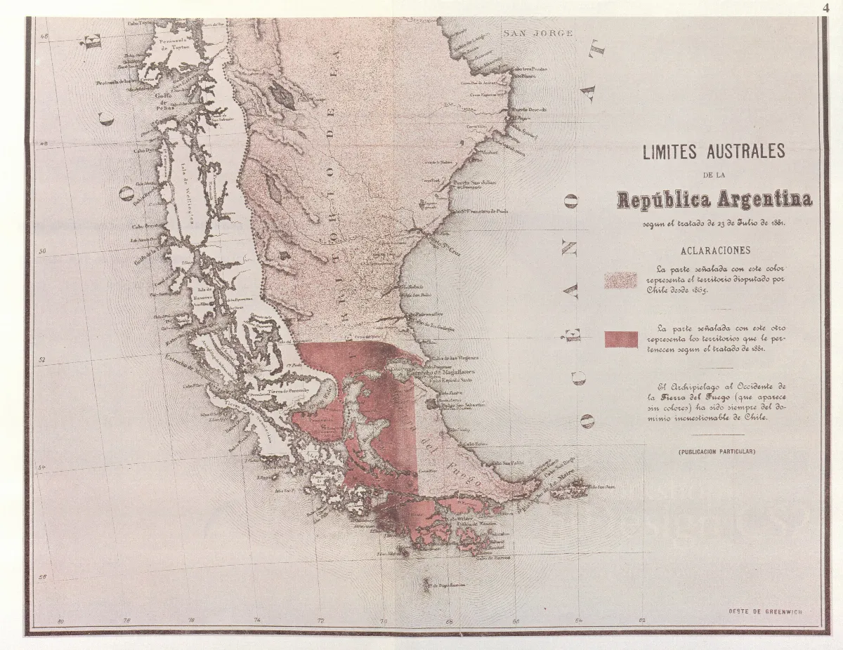
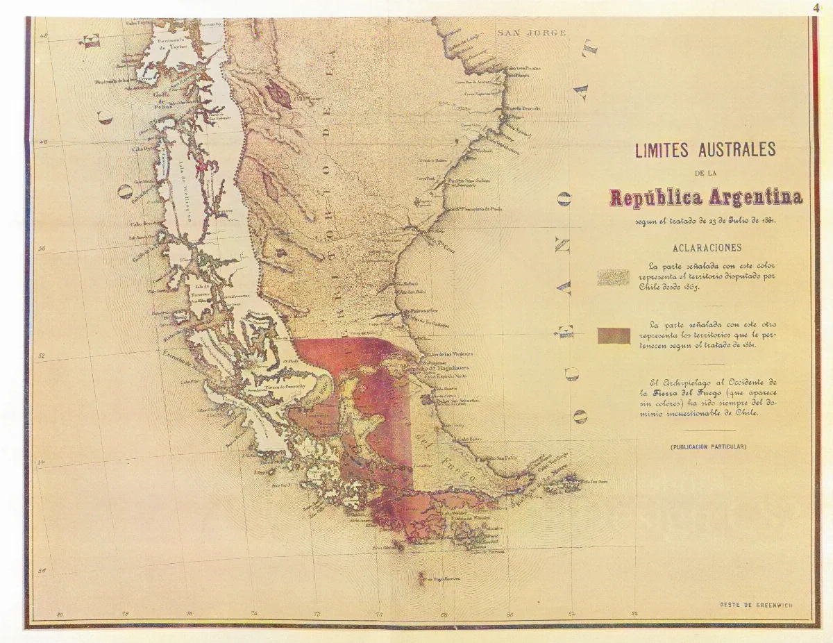
Parcial reproduction of the first argentinian map showing the boundaries laid down in the Boundary Treaty of 23 July 1881, appeared in "La Ilustracion Argentina" issue of 10 November 1881 in Buenos Aires. The copy reproduced here is one handed to the British Minister Plenipontentiary in Buenos Aires by Dr. Bernardo de Irigoyen, Argentine Minister of Forein Affairs who negotiated and signed the Boundary Treaty. The original is located in the official British Archives. The British Minister sent it to his Government with the comment that the dark shaded area "comprising the Strait of Magellan, half of Tierra del Fuego and all the southern islands, represent was actually has been ceded to Chile by the recent Treaty."
Licencia1881 (Ano)
from magazin "La Ilustracion argentina" — Wikimedia Commons (Dominio público)
from magazin "La Ilustracion argentina"
Wikimedia Commons
Comentarios
No hay comentarios aún. Sé el primero en comentar.