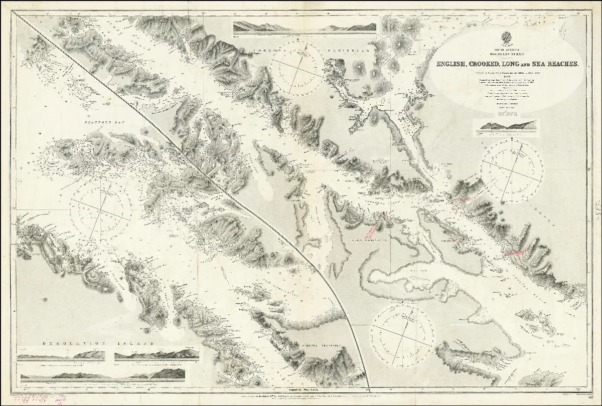
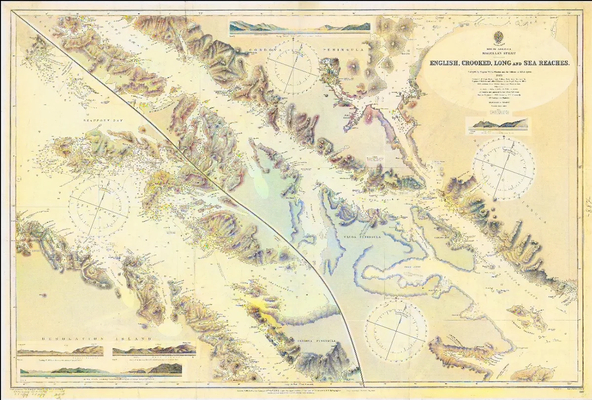
Admiralty Chart No 887 Magellan Strait English, Crooked, Long and Sea Reaches. Surveyed by Captain W.J.L. Wharton and the Officers of H.M.S. Sylvia, Published 1884
Magellan Strait English, Crooked, Long and Sea Reaches. Surveyed by Captain W.J.L. Wharton and the Officers of H.M.S. Sylvia
Licencia Fecha
1915 (Ano)
Lugar +5 pts
Etiquetas
Wikimedia Commons
Década 1910
Fuente / Crédito
Instituto Hidrográfico del Reino Unido — Wikimedia Commons (Dominio público)
Parte del fondo
Fondo Wikimedia Commons — Chile CDA-WIKI-001 Fotógrafo
Instituto Hidrográfico del Reino Unido Subida por
Wikimedia Commons
Comentarios
No hay comentarios aún. Sé el primero en comentar.